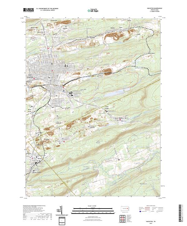
2023 Map of Hazleton
USGS Topo · Published 2023About this map
Coal-country heritage and deep ethnic roots define the landscape of Hazleton and its surrounding boroughs. The map reveals an incredible density of religious sites and cemeteries, illustrating the immigrant communities that settled near the anthracite mines, such as the Saint Michaels Ukrainian Catholic Church Cem, Saints Peter and Paul Polish National Cem, and the Holy Trinity Russian Orthodox Cem. This religious geography is anchored by the tragic history of the region, specifically marked at the Stockton Mine Disaster Cem.
Find a feature on this map
197 named features on this map. Tap any name to fly to it.
Don’t see what you’re looking for? This feature index may not catch every label — zoom into the map to look around manually.
Map Details
Editions of this 2023 Hazleton Map
This is the sole edition of this map. No revisions or reprints were ever made.
Other maps of this area

1889 · Hazleton
USGS Topo · 1:62,500

1891 · Wilkesbarre
USGS Topo · 1:62,500

1891 · Hazleton
USGS Topo · 1:62,500

1892 · Mahanoy
USGS Topo · 1:62,500

1893 · Hazleton
USGS Topo · 1:62,500

1893 · Mahanoy
USGS Topo · 1:62,500

1894 · Shickshinny
USGS Topo · 1:62,500

1894 · Wilkesbarre
USGS Topo · 1:62,500

1943 · Scranton
USGS Topo · 1:125,000

1944 · Newark
USGS Topo · 1:250,000