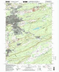
1997 Map of Hazleton
USGS Topo · Published 2000About this map
Hazleton and West Hazleton serve as the dense urban core of this Anthracite region study, surrounded by a constellation of smaller mining settlements like Ebervale, Lattimer, and Jeddo. The landscape is profoundly shaped by industry, featuring several large Strip Mine operations and industrial infrastructure such as the Water Filtration Plant and Sewage Disposal Ponds. Transportation corridors are well-defined by the Hazleton Municipal Airport and historical remnants like the Old RR Grade, which speak to the area's transition from a rail-dependent coal economy to modern utility and air travel.
Find a feature on this map
76 named features on this map. Tap any name to fly to it.
Don’t see what you’re looking for? This feature index may not catch every label — zoom into the map to look around manually.
Map Details
Editions of this 1997 Hazleton Map
This is the sole edition of this map. No revisions or reprints were ever made.
Other maps of this area

1889 · Hazleton
USGS Topo · 1:62,500

1891 · Wilkesbarre
USGS Topo · 1:62,500

1891 · Hazleton
USGS Topo · 1:62,500

1892 · Mahanoy
USGS Topo · 1:62,500

1893 · Hazleton
USGS Topo · 1:62,500

1893 · Mahanoy
USGS Topo · 1:62,500

1894 · Shickshinny
USGS Topo · 1:62,500

1894 · Wilkesbarre
USGS Topo · 1:62,500

1943 · Scranton
USGS Topo · 1:125,000

1944 · Newark
USGS Topo · 1:250,000