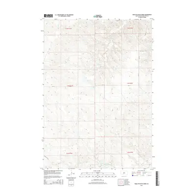
2015 Map of Head of Butch Creek
USGS Topo · Published 2015About this map
Nielson Ranch stands as a primary point of human settlement in this high-plains landscape of Mellette County, where the terrain is defined by a dense network of seasonal drainages. This map illustrates the intricate headwaters of Butch Cr, which carves through the central portion of the quadrangle alongside Roundup Cr. The landscape is etched with the drainage patterns of Cedar Cr and Cottonwood Cr, reflecting the natural hydrology that has long influenced ranching and land use in South Dakota. Transport is concentrated along rural routes such as Butch Creek Rd and the appropriately named Roundup Rd, providing a detailed look at the infrastructure supporting the remote agricultural operations of the region during the mid-2010s.
Find a feature on this map
16 named features on this map. Tap any name to fly to it.
Don’t see what you’re looking for? This feature index may not catch every label — zoom into the map to look around manually.
Map Details
Editions of this 2015 Head of Butch Creek Map
This is the sole edition of this map. No revisions or reprints were ever made.
Other maps of this area

1951 · Stamford SE
USGS Topo · 1:24,000

1951 · Cedar Butte NE
USGS Topo · 1:24,000

1951 · Okaton SW
USGS Topo · 1:24,000

1951 · Murdo 3 NW
USGS Topo · 1:24,000

1951 · Murdo 3 NE
USGS Topo · 1:24,000

1951 · Okaton SE
USGS Topo · 1:24,000

1955 · Martin
USGS Topo · 1:250,000

1958 · Martin
USGS Topo · 1:250,000

1980 · Kadoka
USGS Topo · 1:100,000

1981 · Cedar Butte
USGS Topo · 1:25,000