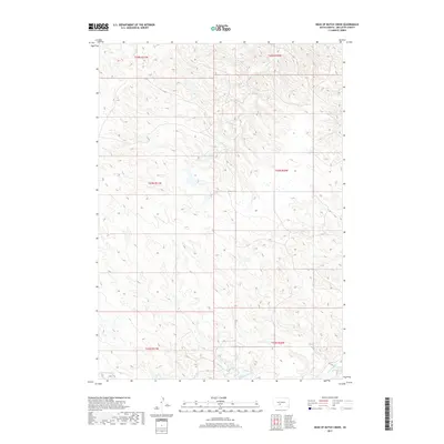
2017 Map of Head of Butch Creek
USGS Topo · Published 2017About this map
Butch Cr and its headwaters carve through this portion of the Swift Bear Segment in South Dakota, defining a landscape of high prairie drainages. The area is characterized by the complex branching of several key waterways, including Roundup Cr and Cottonwood Cr, which create a natural network across the terrain. Located within the boundaries of Mellette County, the map illustrates the expansive township and range divisions of the early 21st century, such as t43n r31w and t43n r30w. The convergence of these drainage systems, particularly where Cedar Cr enters the frame, highlights the subtle but significant topography that dictates the movement of water and the historical management of this western landscape.
Find a feature on this map
10 named features on this map. Tap any name to fly to it.
Don’t see what you’re looking for? This feature index may not catch every label — zoom into the map to look around manually.
Map Details
Editions of this 2017 Head of Butch Creek Map
This is the sole edition of this map. No revisions or reprints were ever made.
Other maps of this area

1951 · Stamford SE
USGS Topo · 1:24,000

1951 · Cedar Butte NE
USGS Topo · 1:24,000

1951 · Okaton SW
USGS Topo · 1:24,000

1951 · Murdo 3 NW
USGS Topo · 1:24,000

1951 · Murdo 3 NE
USGS Topo · 1:24,000

1951 · Okaton SE
USGS Topo · 1:24,000

1955 · Martin
USGS Topo · 1:250,000

1958 · Martin
USGS Topo · 1:250,000

1980 · Kadoka
USGS Topo · 1:100,000

1981 · Cedar Butte
USGS Topo · 1:25,000