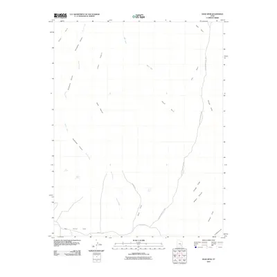
2010 Map of Head Spur
USGS Topo · Published 2010About this map
Horseshoe Canyon and the winding course of Barrier Creek dominate this desert landscape within Glen Canyon National Park. The survey details a highly eroded plateau system where prominent landmarks like Head Spur, High Spur, and The Spur rise above deep drainages. Access to this remote backcountry is traced through Hans Flat Rd and Rec Road 777, which cross the expansive Hans Flats.
Find a feature on this map
20 named features on this map. Tap any name to fly to it.
Don’t see what you’re looking for? This feature index may not catch every label — zoom into the map to look around manually.
Map Details
Editions of this 2010 Head Spur Map
This is the sole edition of this map. No revisions or reprints were ever made.
Other maps of this area

1885 · San Rafael
USGS Topo · 1:250,000

1953 · Orange Cliffs 1 SE
USGS Topo · 1:24,000

1953 · Orange Cliffs 4 NW
USGS Topo · 1:24,000

1953 · Orange Cliffs 4 NE
USGS Topo · 1:24,000

1953 · Orange Cliffs 3 NE
USGS Topo · 1:24,000

1953 · Orange Cliffs 1 NE
USGS Topo · 1:24,000

1953 · The Spur
USGS Topo · 1:62,500

1953 · Fiddler Butte
USGS Topo · 1:62,500

1953 · Orange Cliffs
USGS Topo · 1:62,500

1956 · Salina
USGS Topo · 1:250,000