
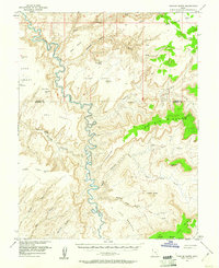
1953 Map of Fiddler Butte
USGS Topo · Published 1958About this map
The Dirty Devil River carves a deep, serpentine path through this 1950s landscape, serving as a stark natural boundary between the high plateaus of Sams Mesa and Bert Mesa. The terrain is defined by its dramatic verticality, where isolated landmarks like Fiddler Butte and The Pinnacle rise above a complex network of drainages including Poison Spring Canyon and Hatch Canyon. Evidence of human activity and aviation history is sparse but present, marked by a Landing Strip near the head of Happy Canyon and scattered prospects. Notable water sources such as Sams Mesa Spring and Two Pipe Springs represent critical points in this arid environment. The map also records early infrastructure, including a Tunnel and various surveying benchmarks like VABM 6391 Fiddler, reflecting the mid-century effort to document this portion of the Wayne and Garfield County line.
Find a feature on this map
42 named features on this map. Tap any name to fly to it.
Don’t see what you’re looking for? This feature index may not catch every label — zoom into the map to look around manually.
Map Details
Editions of this 1953 Fiddler Butte Map
3 editions found
Other maps of this area

1885 · San Rafael
USGS Topo · 1:250,000

1886 · Henry Mountains
USGS Topo · 1:250,000

1892 · Henry Mountains
USGS Topo · 1:250,000

1952 · Mouth of Dark Canyon
USGS Topo · 1:62,500

1952 · Orange Cliffs 3 SW
USGS Topo · 1:24,000

1952 · Mt Pennell 1 NE
USGS Topo · 1:24,000

1952 · Mt Hillers
USGS Topo · 1:62,500

1952 · Hite
USGS Topo · 1:62,500

1952 · Bull Mountain
USGS Topo · 1:62,500

1953 · Orange Cliffs 3 SE
USGS Topo · 1:24,000