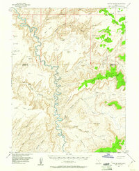
1953 Map of Fiddler Butte
USGS Topo · Published 1961About this map
The Dirty Devil River winds through a deeply incised landscape in this mid-century survey of the Wayne and Garfield County line. The geography is characterized by high, isolated plateaus such as Sams Mesa and Bert Mesa, which are separated from the surrounding lowlands by dramatic topographic drops. Human presence is sparse, marked primarily by a landing strip near The Big Ridge and a prospect site located near Poison Spring Canyon, reflecting the era's mineral exploration interests which involved the Atomic Energy Commission.
Find a feature on this map
32 named features on this map. Tap any name to fly to it.
Don’t see what you’re looking for? This feature index may not catch every label — zoom into the map to look around manually.
Map Details
Editions of this 1953 Fiddler Butte Map
3 editions found

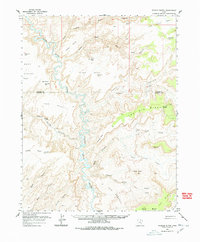
Other maps of this area

1885 · San Rafael
USGS Topo · 1:250,000

1886 · Henry Mountains
USGS Topo · 1:250,000

1892 · Henry Mountains
USGS Topo · 1:250,000

1952 · Mouth of Dark Canyon
USGS Topo · 1:62,500

1952 · Orange Cliffs 3 SW
USGS Topo · 1:24,000

1952 · Mt Pennell 1 NE
USGS Topo · 1:24,000

1952 · Mt Hillers
USGS Topo · 1:62,500

1952 · Hite
USGS Topo · 1:62,500

1952 · Bull Mountain
USGS Topo · 1:62,500

1953 · Orange Cliffs 3 SE
USGS Topo · 1:24,000