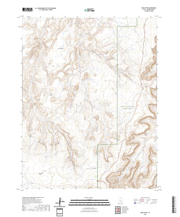
2023 Map of Head Spur
USGS Topo · Published 2023About this map
Hans Flats and the elevated plateau of Head Spur define this high-desert landscape in eastern Wayne County. The map details the transition from level grazing lands like Lower Pasture and Upper Pasture into the complex drainage systems of Horseshoe Canyon and Millard Canyon. A portion of the Glen Canyon National Recreation Area is visible along the eastern edge, characterized by the dramatic Orange Cliffs and the branching waterways of Moqui Fork and Spur Fork. Small water sources such as Outlaw Spring and Wildcat Spring serve as critical landmarks in an otherwise arid environment. The presence of a Natural Arch and the winding Orange Cliffs Trl illustrate the geological complexity and primitive transportation routes that connect these remote mesas and canyons.
Find a feature on this map
22 named features on this map. Tap any name to fly to it.
Don’t see what you’re looking for? This feature index may not catch every label — zoom into the map to look around manually.
Map Details
Editions of this 2023 Head Spur Map
This is the sole edition of this map. No revisions or reprints were ever made.
Other maps of this area

1885 · San Rafael
USGS Topo · 1:250,000

1953 · Orange Cliffs 1 SE
USGS Topo · 1:24,000

1953 · Orange Cliffs 4 NW
USGS Topo · 1:24,000

1953 · Orange Cliffs 4 NE
USGS Topo · 1:24,000

1953 · Orange Cliffs 3 NE
USGS Topo · 1:24,000

1953 · Orange Cliffs 1 NE
USGS Topo · 1:24,000

1953 · The Spur
USGS Topo · 1:62,500

1953 · Fiddler Butte
USGS Topo · 1:62,500

1953 · Orange Cliffs
USGS Topo · 1:62,500

1956 · Salina
USGS Topo · 1:250,000