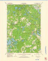
1966 Map of Heafford Junction
USGS Topo · Published 1968About this map
American Legion State Forest covers the northern reaches of this Wisconsin lake district, where numerous glacial lakes like Bearskin Lake and Horsehead Lake dot the landscape. The mid-1960s terrain is characterized by a dense network of water bodies and marshlands such as Cranberry Bog, with transportation shaped by the crossing of the Chicago Milwaukee ST Paul And Pacific and the Chicago And North Western railroads. Small clusters of settlement are concentrated at Heafford Junction and Goodnow, the latter featuring the Pinewood Country Club and Goodnow Cem.
Find a feature on this map
151 named features on this map. Tap any name to fly to it.
Don’t see what you’re looking for? This feature index may not catch every label — zoom into the map to look around manually.
Map Details
Editions of this 1966 Heafford Junction Map
This is the sole edition of this map. No revisions or reprints were ever made.
Other maps of this area

1930 · Robbins
USGS Topo · 1:48,000

1938 · Minocqua
USGS Topo · 1:48,000

1938 · Robbins
USGS Topo · 1:48,000

1938 · Lac Du Flambeau
USGS Topo · 1:48,000

1939 · Lac Du Flambeau
USGS Topo · 1:48,000

1939 · Mc Cord
USGS Topo · 1:48,000

1939 · Cassian
USGS Topo · 1:48,000

1940 · Parrish
USGS Topo · 1:48,000

1940 · Rhinelander
USGS Topo · 1:48,000

1942 · Cassian
USGS Topo · 1:48,000