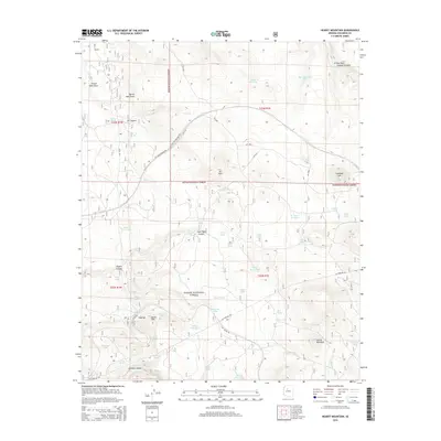
2014 Map of Hearst Mountain
USGS Topo · Published 2014About this map
Kaibab National Forest dominates this landscape in northern Arizona, where the high desert terrain is marked by isolated peaks and seasonal water catchments. The small settlement of Corva and nearby Corva Hill sit in the southwestern portion of the sheet, connected to the wider region by a network of specialized routes including the BNSF RR Frontage Rd and the Gas Pipeline Rd. The land is characterized by numerous livestock tanks such as Tea Cup Tank, Button Tank, and Holden Lake, which illustrate the area's historical reliance on water management for ranching. To the north and east, the topography becomes more pronounced with features like Coxcomb Hill and the prominent Hearst Mountain. Deep drainage patterns are visible through Cataract Canyon and Polson Dam Draw, revealing the erosive forces that shape this volcanic and sedimentary plateau near the Grand Canyon region.
Find a feature on this map
59 named features on this map. Tap any name to fly to it.
Don’t see what you’re looking for? This feature index may not catch every label — zoom into the map to look around manually.
Map Details
Editions of this 2014 Hearst Mountain Map
This is the sole edition of this map. No revisions or reprints were ever made.
Other maps of this area

1886 · Chino
USGS Topo · 1:250,000

1891 · Chino
USGS Topo · 1:250,000

1922 · Williams
USGS Topo · 1:125,000

1947 · Ash Fork
USGS Topo · 1:62,500

1948 · Ash Fork
USGS Topo · 1:63,360

1948 · Williams
USGS Topo · 1:250,000

1949 · Ash Fork
USGS Topo · 1:62,500

1954 · Williams
USGS Topo · 1:250,000

1956 · Williams
USGS Topo · 1:250,000

1960 · Williams
USGS Topo · 1:250,000