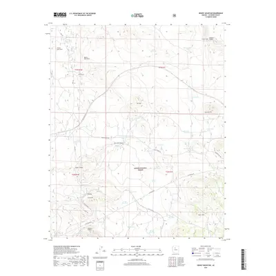
2018 Map of Hearst Mountain
USGS Topo · Published 2018About this map
Corva stands as a focal point in this high-desert landscape of Coconino County, situated near the dramatic southern reaches of Cataract Canyon. The terrain is defined by a series of named ridges and canyons, including Hearst Mtn, Coxcomb Hill, and the winding Juan Tank Canyon. This 2018 survey reveals a landscape heavily managed for water and infrastructure within the Kaibab National Forest. Numerous livestock or catchment points like Mud-Ketch Tank, Perrin Tank, and Tea Cup Tank are scattered across the drainage basins of Cataract Cr and Johnson Cr. Transportation and utility corridors such as the Gas Pipeline Rd. and the R.R. Maintenance Rd. cut across the natural topography, highlighting the region's role as a modern transit artery through the Arizona wilderness.
Find a feature on this map
53 named features on this map. Tap any name to fly to it.
Don’t see what you’re looking for? This feature index may not catch every label — zoom into the map to look around manually.
Map Details
Editions of this 2018 Hearst Mountain Map
This is the sole edition of this map. No revisions or reprints were ever made.
Other maps of this area

1886 · Chino
USGS Topo · 1:250,000

1891 · Chino
USGS Topo · 1:250,000

1922 · Williams
USGS Topo · 1:125,000

1947 · Ash Fork
USGS Topo · 1:62,500

1948 · Ash Fork
USGS Topo · 1:63,360

1948 · Williams
USGS Topo · 1:250,000

1949 · Ash Fork
USGS Topo · 1:62,500

1954 · Williams
USGS Topo · 1:250,000

1956 · Williams
USGS Topo · 1:250,000

1960 · Williams
USGS Topo · 1:250,000