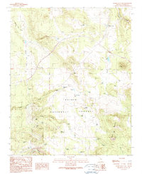
1989 Map of Hearst Mountain
USGS Topo · Published 1990About this map
Kaibab National Forest dominates this northern Arizona landscape, where the high-altitude terrain is defined by a sophisticated network of water catchment systems essential for ranching. The map reveals the intricate water management of the late 20th century, featuring dozens of named reservoirs and tanks such as KY Tank, Mud Ketch Tank, and Tea Cup Tank scattered across the high country. These features, along with names like Buss Ranch, highlight the region's enduring cattle-ranching heritage.
Find a feature on this map
56 named features on this map. Tap any name to fly to it.
Don’t see what you’re looking for? This feature index may not catch every label — zoom into the map to look around manually.
Map Details
Editions of this 1989 Hearst Mountain Map
This is the sole edition of this map. No revisions or reprints were ever made.
Other maps of this area

1886 · Chino
USGS Topo · 1:250,000

1891 · Chino
USGS Topo · 1:250,000

1922 · Williams
USGS Topo · 1:125,000

1947 · Ash Fork
USGS Topo · 1:62,500

1948 · Ash Fork
USGS Topo · 1:63,360

1948 · Williams
USGS Topo · 1:250,000

1949 · Ash Fork
USGS Topo · 1:62,500

1954 · Williams
USGS Topo · 1:250,000

1956 · Williams
USGS Topo · 1:250,000

1960 · Williams
USGS Topo · 1:250,000