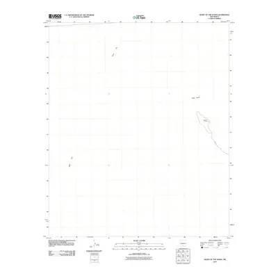
2010 Map of Heart of the Sands
USGS Topo · Published 2010About this map
White Sands dominates this 2010 survey of the New Mexico desert, illustrating the minimal human footprint in this unique environmental landscape. The geological character of the region is defined by the extensive Alkali Flat, which stretches across the western portion of the quadrangle. A significant geographic marker, the Heart of the Sands, is situated along the eastern edge, showing the specific dune formations that characterize the area. Infrastructure is nearly non-existent in this arid interior, with the notable exception of Loop Dr, a lone road providing access into the dunes from the east. This map serves as a clear record of the area's physical geography before any major contemporary shifts in the Tularosa Basin's shifting sands.
Find a feature on this map
4 named features on this map. Tap any name to fly to it.
Don’t see what you’re looking for? This feature index may not catch every label — zoom into the map to look around manually.
Map Details
Editions of this 2010 Heart of the Sands Map
This is the sole edition of this map. No revisions or reprints were ever made.
Other maps of this area

1916 · Point Of Sands
USGS Topo · 1:125,000

1947 · Point Of Sands 2
USGS Topo · 1:62,500

1947 · Lake Lucero
USGS Topo · 1:62,500

1948 · Tres Hermanos
USGS Topo · 1:62,500

1948 · Holloman
USGS Topo · 1:62,500

1948 · Lake Lucero
USGS Topo · 1:24,000
1950 · Lake Lucero
USGS Topo · 1:24,000
1950 · Lake Lucero NE
USGS Topo · 1:24,000

1955 · Las Cruces
USGS Topo · 1:250,000

1958 · Las Cruces
USGS Topo · 1:250,000