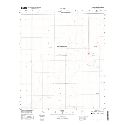
2017 Map of Heart of the Sands
USGS Topo · Published 2017About this map
White Sands National Monument defines this landscape of gypsum dunes and basins in Otero County. The map details the central portion of this environment, including the eponymous Heart of the Sands and the expansive Alkali Flat. Human infrastructure is sparse, limited to recreation and military activity, with Dunes Drive providing the primary vehicular access into the dunes.
Find a feature on this map
14 named features on this map. Tap any name to fly to it.
Don’t see what you’re looking for? This feature index may not catch every label — zoom into the map to look around manually.
Map Details
Editions of this 2017 Heart of the Sands Map
This is the sole edition of this map. No revisions or reprints were ever made.
Other maps of this area

1916 · Point Of Sands
USGS Topo · 1:125,000

1947 · Point Of Sands 2
USGS Topo · 1:62,500

1947 · Lake Lucero
USGS Topo · 1:62,500

1948 · Tres Hermanos
USGS Topo · 1:62,500

1948 · Holloman
USGS Topo · 1:62,500

1948 · Lake Lucero
USGS Topo · 1:24,000
1950 · Lake Lucero
USGS Topo · 1:24,000
1950 · Lake Lucero NE
USGS Topo · 1:24,000

1955 · Las Cruces
USGS Topo · 1:250,000

1958 · Las Cruces
USGS Topo · 1:250,000