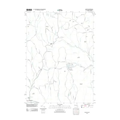
2012 Map of Heath
USGS Topo · Published 2012About this map
Heath and the surrounding Franklin County uplands are defined by a network of steep ridgelines and narrow brook valleys. The primary village centers of North Heath and Dell are connected by winding routes like Heath Rd and Colrain Stage Rd, which navigate the elevation shifts between Pocumtuck Mountain and Stone Mountain. Historically significant sites for genealogists include the Center Cem and South Cem, while the Bissell Covered Bridge near Charlemont marks a vital crossing of the Mill Brook. This landscape is heavily shaped by its hydrology, with numerous streams such as Davis Mine Brook and Hartwell Brook draining the southern slopes toward the Deerfield River basin. Modern residential development is visible around the Davenport Brook Reservoir with local routes like Papoose Lake Dr and Navano Ln carved into the hillsides.
Find a feature on this map
129 named features on this map. Tap any name to fly to it.
Don’t see what you’re looking for? This feature index may not catch every label — zoom into the map to look around manually.
Map Details
Editions of this 2012 Heath Map
This is the sole edition of this map. No revisions or reprints were ever made.
Other maps of this area

1886 · Hawley
USGS Topo · 1:62,500

1889 · Wilmington
USGS Topo · 1:62,500

1890 · Hawley
USGS Topo · 1:62,500

1890 · Greenfield
USGS Topo · 1:62,500

1891 · Wilmington
USGS Topo · 1:62,500

1891 · Brattleboro
USGS Topo · 1:62,500

1893 · Brattleboro
USGS Topo · 1:62,500

1894 · Greenfield
USGS Topo · 1:62,500

1894 · Hawley
USGS Topo · 1:62,500

1899 · Wilmington
USGS Topo · 1:62,500