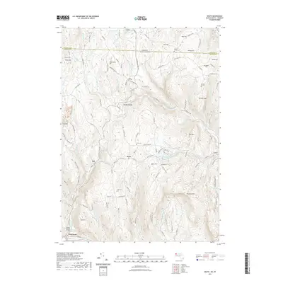
2021 Map of Heath
USGS Topo · Published 2021About this map
Heath and North Heath anchor this high-relief landscape along the border of Massachusetts and Vermont, where the terrain transitions from the heights of Pocumtuck Mtn and Stone Mtn toward the Deerfield River valley. The map reveals a community defined by its cemeteries, such as Center Cem and South Cem, and historical river crossings like the Bissell Covered Bridge in Charlemont. Numerous brooks, including Mill Brook and Avery Brook, carve through the hills, feeding into local impoundments like the Davenport Brook Reservoir. The distribution of family-named peaks, such as Underwood Hill and Phillips Hill, alongside small hamlets like Dell, illustrates a settlement pattern deeply rooted in the upland topography of Franklin County. This survey detail captures the modern road network, including Colrain Stage Rd, superimposed over the enduring natural drainage of the West Branch North River.
Find a feature on this map
140 named features on this map. Tap any name to fly to it.
Don’t see what you’re looking for? This feature index may not catch every label — zoom into the map to look around manually.
Map Details
Editions of this 2021 Heath Map
This is the sole edition of this map. No revisions or reprints were ever made.
Other maps of this area

1886 · Hawley
USGS Topo · 1:62,500

1889 · Wilmington
USGS Topo · 1:62,500

1890 · Hawley
USGS Topo · 1:62,500

1890 · Greenfield
USGS Topo · 1:62,500

1891 · Wilmington
USGS Topo · 1:62,500

1891 · Brattleboro
USGS Topo · 1:62,500

1893 · Brattleboro
USGS Topo · 1:62,500

1894 · Greenfield
USGS Topo · 1:62,500

1894 · Hawley
USGS Topo · 1:62,500

1899 · Wilmington
USGS Topo · 1:62,500