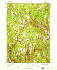
1950 Map of Heath
USGS Topo · Published 1958About this map
Heath and its surrounding hill country in Franklin County are defined by a network of upland roads and small rural settlements during the mid-twentieth century. The terrain is marked by prominent elevations like Pocumtuck Mountain and Stone Mountain, with the West Branch North River carving through the eastern landscape near Adamsville. This survey reveals the distribution of early civic life, from the North Sch and Branch Sch to several scattered burying grounds, including Maple Grove Cem and Center Cem. A notable industrial landmark is the Davis Mine located in the western hills of Rowe, suggesting the area's history of mineral extraction. Much of the northeast corner is occupied by the Colrain State Forest, where the landscape transitions from worked farmland and family-named roads like Stetson Road and Burrington Road into managed timberland. The map captures a moment before modern consolidation, where isolated schoolhouses and local mills still anchored these mountain communities.
Find a feature on this map
89 named features on this map. Tap any name to fly to it.
Don’t see what you’re looking for? This feature index may not catch every label — zoom into the map to look around manually.
Map Details
Editions of this 1950 Heath Map
This is the sole edition of this map. No revisions or reprints were ever made.
Other maps of this area

1886 · Hawley
USGS Topo · 1:62,500

1889 · Wilmington
USGS Topo · 1:62,500

1890 · Hawley
USGS Topo · 1:62,500

1890 · Greenfield
USGS Topo · 1:62,500

1891 · Wilmington
USGS Topo · 1:62,500

1891 · Brattleboro
USGS Topo · 1:62,500

1893 · Brattleboro
USGS Topo · 1:62,500

1894 · Greenfield
USGS Topo · 1:62,500

1894 · Hawley
USGS Topo · 1:62,500

1899 · Wilmington
USGS Topo · 1:62,500