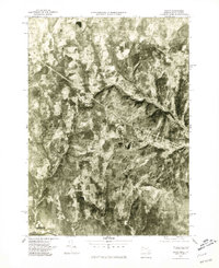
1975 Map of Heath
USGS Topo · Published 1981About this map
Heath and its surrounding hill country appear in stark detail through 1975 orthophotography, revealing the scattered homesteads and woodland clearings of western Franklin County. The imagery captures the rugged transition from the Deerfield River valley in the south, near Charlemont, up into the higher elevations where the West Branch North River carves a deep valley across the center of the sheet. Unlike standard topographic maps, this imagery shows the actual forest cover and field patterns around small settlements like Dell and Adamsville. From the heights of Pocumtuck Mountain to the crossroads at North Heath, the map documents the rural footprint of these upland communities, showing the exact relationship between the remaining open pastures and the advancing forest during the mid-1970s.
Find a feature on this map
8 named features on this map. Tap any name to fly to it.
Don’t see what you’re looking for? This feature index may not catch every label — zoom into the map to look around manually.
Map Details
Editions of this 1975 Heath Map
This is the sole edition of this map. No revisions or reprints were ever made.
Other maps of this area

1886 · Hawley
USGS Topo · 1:62,500

1889 · Wilmington
USGS Topo · 1:62,500

1890 · Hawley
USGS Topo · 1:62,500

1890 · Greenfield
USGS Topo · 1:62,500

1891 · Wilmington
USGS Topo · 1:62,500

1891 · Brattleboro
USGS Topo · 1:62,500

1893 · Brattleboro
USGS Topo · 1:62,500

1894 · Greenfield
USGS Topo · 1:62,500

1894 · Hawley
USGS Topo · 1:62,500

1899 · Wilmington
USGS Topo · 1:62,500