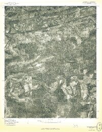
1976 Map of Heavener SE
USGS Topo · Published 1976About this map
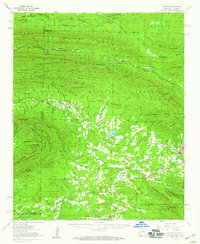
The winding Poteau River carves through the northern landscape of Le Flore County in this 1976 orthophotoquad, which uses aerial photography to document the varied terrain of the Ouachita Mountains foothills. The image captures a detailed perspective on the region's land use, contrasting the meandering river bottomlands with the dense, textured woodlands to the south. Small rural communities serve as the primary points of human settlement, including Petros in the northwestern corner and Hontubby further east along the river. In the southern half of the map, the settlements of Haw Creek and Stapp appear, connected by winding rural roads that navigate the ridges and valleys. This specific aerial survey provides researchers with a precise look at the forest cover and agricultural clearing patterns before the further development of the late twentieth century.
Find a feature on this map
5 named features on this map. Tap any name to fly to it.
Don’t see what you’re looking for? This feature index may not catch every label — zoom into the map to look around manually.
Map Details
Editions of this 1976 Heavener SE Map
This is the sole edition of this map. No revisions or reprints were ever made.
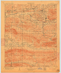
Other maps of this area

1887 · Poteau Mountain #2
USGS Topo · 1:62,500

1890 · Poteau Mountain
USGS Topo · 1:125,000

1899 · Poteau Mountain
USGS Topo · 1:125,000

1900 · Winding Stair
USGS Topo · 1:125,000
1909 · Winding Stair
USGS Topo · 1:125,000

1950 · Mcalester
USGS Topo · 1:250,000
1958 · Loving
USGS Topo · 1:24,000
1958 · Bates
USGS Topo · 1:62,500
1958 · Potter
USGS Topo · 1:62,500
1958 · Bates
USGS Topo · 1:24,000