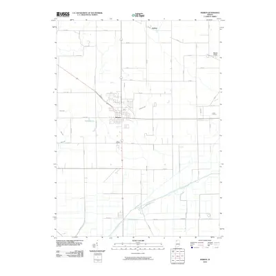
2010 Map of Hebron
USGS Topo · Published 2010About this map
Hebron serves as the central hub of this Porter County landscape, where a dense residential grid transitions into the organized agricultural geometry of northern Indiana. The town is flanked by smaller settlements like Hurlburt to the north and Boone Grove to the northeast, illustrating the late-modern settlement pattern of the region. The southern portion of the quadrangle is defined by the significant corridor of the Kankakee River, which is paralleled by Ramsey Rd and Dike Rd. This riverine landscape is heavily modified by an extensive drainage network, including Henderson Ditch, Kithcart Ditch, and Cook Ditch, reflecting over a century of land reclamation efforts to support the surrounding farmland. Genealogists can identify key burial sites such as Hebron Cemetery and the more remote Cornell Cemetery situated near the intersection of W 750 S and S 300 W.
Find a feature on this map
48 named features on this map. Tap any name to fly to it.
Don’t see what you’re looking for? This feature index may not catch every label — zoom into the map to look around manually.
Map Details
Editions of this 2010 Hebron Map
This is the sole edition of this map. No revisions or reprints were ever made.
Other maps of this area

1953 · Leroy
USGS Topo · 1:24,000

1953 · Palmer
USGS Topo · 1:24,000

1953 · Crown Point
USGS Topo · 1:24,000

1953 · Hebron
USGS Topo · 1:24,000

1953 · Valparaiso
USGS Topo · 1:24,000

1953 · Kouts
USGS Topo · 1:24,000

1953 · Chicago
USGS Topo · 1:250,000

1957 · Chicago
USGS Topo · 1:250,000

1957 · Wheatfield
USGS Topo · 1:24,000

1957 · DeMotte
USGS Topo · 1:24,000