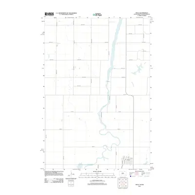
2012 Map of Hecla
USGS Topo · Published 2012About this map
The town of Hecla sits at the intersection of prairie grid roads and the northern reaches of the James River, a landscape defined by its meandering waterways and agricultural layout. The river valley dominates the central terrain, characterized by wide bends and proximity to local drainage features like Dry Run and Hyatt Slough. This 2012 USGS study documents the town's street grid, including its historic orientation near Railroad Rd and Depot St, reflecting its origins as a rail-served community. Beyond the town center, family-named routes such as Freudenthal Rd and Mitchell Rd suggest a long-standing pattern of rural landownership and settlement. The map provides a clear look at the hydraulic environment of the region, where the flat topography leads to significant sloughing and seasonal drainage patterns that have influenced local road placement for generations.
Find a feature on this map
35 named features on this map. Tap any name to fly to it.
Don’t see what you’re looking for? This feature index may not catch every label — zoom into the map to look around manually.
Map Details
Editions of this 2012 Hecla Map
This is the sole edition of this map. No revisions or reprints were ever made.
Other maps of this area

1894 · Hecla
USGS Topo · 1:62,500

1894 · Savo
USGS Topo · 1:62,500

1894 · Fullerton
USGS Topo · 1:62,500

1894 · Oakes
USGS Topo · 1:62,500

1895 · Lamoure
USGS Topo · 1:125,000

1896 · Columbia
USGS Topo · 1:125,000

1918 · La Moure
USGS Topo · 1:125,000

1953 · Jamestown
USGS Topo · 1:250,000

1953 · Hecla SE
USGS Topo · 1:24,000

1953 · Houghton
USGS Topo · 1:24,000