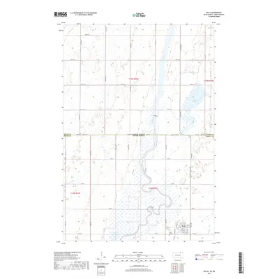
2017 Map of Hecla
USGS Topo · Published 2017About this map
Hecla anchors the southeastern corner of this map, situated where the low-lying prairie meets the meandering course of the James River. This 2017 survey details the township’s grid, from its residential core along Main St and Elm St to the nearby Hecla City Cem. The landscape is defined by the complex hydrology of the James River valley, which supports expansive wetlands like Hyatt Slough and seasonal drainage paths such as Dry Run. Along the northern edge of the quadrangle, the border between Brown County and Dickey County is marked by State Line Rd, signifying the literal boundary between South Dakota and North Dakota. This map captures a region where agriculture and natural floodplains dictate the patterns of rural settlement and infrastructure.
Find a feature on this map
29 named features on this map. Tap any name to fly to it.
Don’t see what you’re looking for? This feature index may not catch every label — zoom into the map to look around manually.
Map Details
Editions of this 2017 Hecla Map
This is the sole edition of this map. No revisions or reprints were ever made.
Other maps of this area

1894 · Hecla
USGS Topo · 1:62,500

1894 · Savo
USGS Topo · 1:62,500

1894 · Fullerton
USGS Topo · 1:62,500

1894 · Oakes
USGS Topo · 1:62,500

1895 · Lamoure
USGS Topo · 1:125,000

1896 · Columbia
USGS Topo · 1:125,000

1918 · La Moure
USGS Topo · 1:125,000

1953 · Jamestown
USGS Topo · 1:250,000

1953 · Hecla SE
USGS Topo · 1:24,000

1953 · Houghton
USGS Topo · 1:24,000