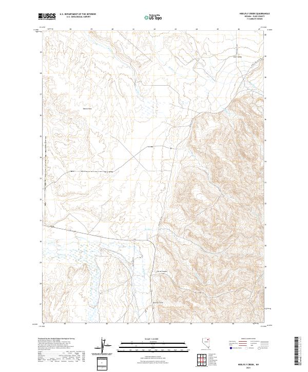
2021 Map of Heelfly Creek
USGS Topo · Published 2021About this map
Starr Valley occupies the northeast corner of this high-desert Elko County landscape, where the Starr Valley Loop and Upper Starr Valley RD service the local community. The terrain is defined by a series of drainages descending from the higher elevations, including Stephens Cr, Reed Cr, and the eponymous Heelfly Cr. These waterways create a network of canyons and gulches, most notably Corral Canyon and Poverty Gulch, which have long shaped the ranching and livestock movement in this portion of Nevada. To the west, the expansive Dennis Flats stretch toward the Ellison Ranch 71 corridor. The map details a transition from the structured ranching properties near the valleys to the more remote drainages of Secret Cr and Soldier Cr in the southwest, illustrating the modern rural infrastructure of the Great Basin.
Find a feature on this map
19 named features on this map. Tap any name to fly to it.
Don’t see what you’re looking for? This feature index may not catch every label — zoom into the map to look around manually.
Map Details
Editions of this 2021 Heelfly Creek Map
This is the sole edition of this map. No revisions or reprints were ever made.
Other maps of this area

1935 · Halleck
USGS Topo · 1:125,000

1955 · Wells
USGS Topo · 1:250,000

1955 · Elko
USGS Topo · 1:250,000

1958 · Wells
USGS Topo · 1:250,000

1958 · Elko
USGS Topo · 1:250,000

1961 · Wells
USGS Topo · 1:250,000

1962 · Elko
USGS Topo · 1:250,000

1965 · Elko
USGS Topo · 1:250,000

1967 · Herder Creek
USGS Topo · 1:24,000
1967 · Deeth
USGS Topo · 1:24,000