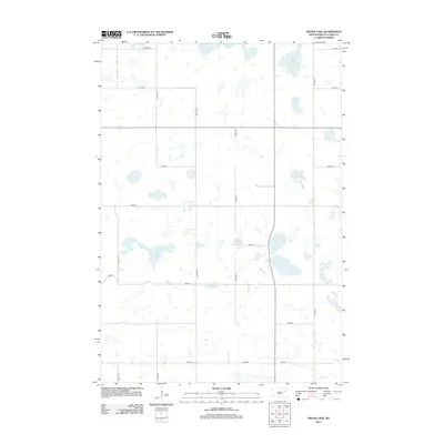
2012 Map of Heggs Lake
USGS Topo · Published 2012About this map
Glacial depressions and marshy basins define this section of Clark County, dominated by the waters of Heggs Lake and Swan Lake along its northern edge. The landscape is a textbook example of the prairie pothole region, where drainage patterns are often internal and dictated by shallow lakes and wetlands like Pepper Slough and Lake Todd. This 2012 survey shows the highly structured section-line road grid that governs the rural territory, with 431st Ave and 433rd Ave cutting across the terrain to connect remote farmsteads. The concentration of water bodies, including Carson Lake, illustrates the vital role of natural hydrology in an area otherwise dedicated to expansive agriculture and section-based land management.
Find a feature on this map
18 named features on this map. Tap any name to fly to it.
Don’t see what you’re looking for? This feature index may not catch every label — zoom into the map to look around manually.
Map Details
Editions of this 2012 Heggs Lake Map
This is the sole edition of this map. No revisions or reprints were ever made.
Other maps of this area

1953 · Milbank
USGS Topo · 1:250,000

1953 · Watertown
USGS Topo · 1:250,000

1958 · Milbank
USGS Topo · 1:250,000

1958 · Watertown
USGS Topo · 1:250,000

1973 · Lily
USGS Topo · 1:24,000

1973 · Swan Lake
USGS Topo · 1:24,000

1973 · Bradley
USGS Topo · 1:24,000

1973 · Florence NW
USGS Topo · 1:24,000

1973 · Wallace
USGS Topo · 1:24,000

1973 · Heggs Lake
USGS Topo · 1:24,000