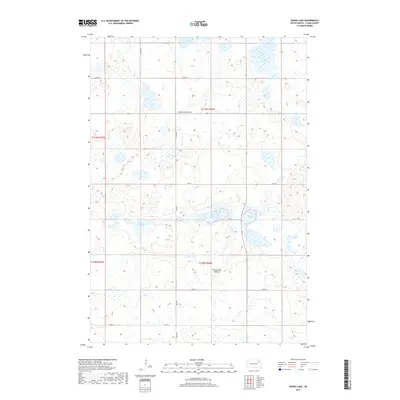
2017 Map of Heggs Lake
USGS Topo · Published 2017About this map
Coteau des Prairies, a high glacial plateau, defines the landscape of this Clark County map. This 2017 study illustrates the complex prairie pothole region, where numerous wetlands and named basins like Heggs Lake and Lake Todd dominate the topography. The distribution of these water bodies suggests a region shaped by glacial recession, creating a labyrinth of small lakes and sloughs. Interspersed among these natural features is a grid of section lines and rural routes, including S Dakota Highway 20 and Co Rd 22, which provide the primary access to the scattered agricultural holdings. The map also identifies Pepper Slough, Carson Lake, and Swan Lake, highlighting the critical hydrography of the northeastern South Dakota plains.
Find a feature on this map
16 named features on this map. Tap any name to fly to it.
Don’t see what you’re looking for? This feature index may not catch every label — zoom into the map to look around manually.
Map Details
Editions of this 2017 Heggs Lake Map
This is the sole edition of this map. No revisions or reprints were ever made.
Other maps of this area

1953 · Milbank
USGS Topo · 1:250,000

1953 · Watertown
USGS Topo · 1:250,000

1958 · Milbank
USGS Topo · 1:250,000

1958 · Watertown
USGS Topo · 1:250,000

1973 · Lily
USGS Topo · 1:24,000

1973 · Swan Lake
USGS Topo · 1:24,000

1973 · Bradley
USGS Topo · 1:24,000

1973 · Florence NW
USGS Topo · 1:24,000

1973 · Wallace
USGS Topo · 1:24,000

1973 · Heggs Lake
USGS Topo · 1:24,000