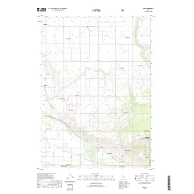
2020 Map of Heise
USGS Topo · Published 2020About this map
The Snake River carves a significant path through this eastern Idaho landscape, where the waters are diverted into an intricate network of irrigation systems including the Enterprise Canal, Farmers Friend Canal, and Sidehill Ditch. This 2020 survey captures the agricultural and geothermal character of the region, anchored by the settlement of Heise and the natural features of the Targhee National Forest. The presence of Elkhorn Warm Spring and Hawley Warm Spring north of the river highlights the area's volcanic geology, while prominent landmarks like Bertha Rock, Blanche Rock, and Kelly Mtn rise above the river valley.
Find a feature on this map
58 named features on this map. Tap any name to fly to it.
Don’t see what you’re looking for? This feature index may not catch every label — zoom into the map to look around manually.
Map Details
Editions of this 2020 Heise Map
This is the sole edition of this map. No revisions or reprints were ever made.
Other maps of this area

1949 · Rexburg
USGS Topo · 1:24,000

1950 · Ririe
USGS Topo · 1:24,000

1950 · Rexburg
USGS Topo · 1:24,000

1950 · Rigby
USGS Topo · 1:62,500

1950 · Rigby SE
USGS Topo · 1:24,000

1951 · Rigby SE
USGS Topo · 1:24,000

1951 · Moody
USGS Topo · 1:24,000

1951 · Poplar
USGS Topo · 1:24,000

1951 · Hawley Gulch
USGS Topo · 1:24,000

1951 · Heise
USGS Topo · 1:24,000