
1932 Map of Helena
USGS Topo · Published 1932About this map
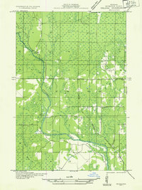
The Escanaba River winds through this section of Marquette County, defining the drainage patterns and early settlement layout in this part of Michigan's Upper Peninsula. In 1932, the landscape was a mix of emerging civic infrastructure and logging-era outposts. The Chicago and Northwestern railroad cuts through the center of the region, providing the primary transport link for local resources. Educational and community life centered around several rural schools, including Ewing Sch No 1, Ewing Sch, and Lincoln Sch, while the presence of Sharkeys Camp and Finn Camp suggests the seasonal or industrial work patterns of the time. The intersection of roads near the Town Hall reveals a localized hub of activity, contrasting with the expansive wetlands and river valleys of the Beaver Branch and Hunters Brook.
Find a feature on this map
13 named features on this map. Tap any name to fly to it.
Don’t see what you’re looking for? This feature index may not catch every label — zoom into the map to look around manually.
Map Details
Editions of this 1932 Helena Map
2 editions found
Other maps of this area

1932 · Rock SW
USGS Topo · 1:31,680

1932 · Helena NW
USGS Topo · 1:31,680

1932 · Helena NE
USGS Topo · 1:31,680

1932 · Whitney NE
USGS Topo · 1:31,680

1932 · Helena SW
USGS Topo · 1:31,680

1932 · Rock NW
USGS Topo · 1:31,680

1932 · Gladstone NW
USGS Topo · 1:31,680

1950 · Gladstone NW
USGS Topo · 1:31,680

1951 · Helena SW
USGS Topo · 1:31,680

1951 · Helena
USGS Topo · 1:31,680