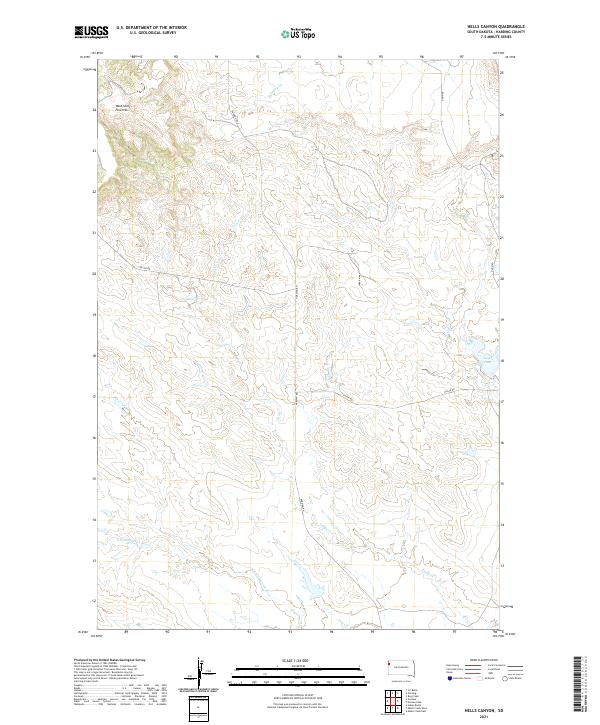
2021 Map of Hells Canyon
USGS Topo · Published 2021About this map
West Short Pine Hills dominates the northwestern corner of this territory, where the complex drainage of Hells Canyon gives way to the broader plateau of Harding County. The landscape is defined by its seasonal water systems, most notably the S Fork Moreau River winding through the southern sections and the northern reach of Valley Cr. Agricultural and ranching infrastructure is evident at the Leger Dam near the eastern boundary, which captures runoff from the surrounding drainages. A grid of rural routes, including Harding Rd and Collins Rd, provides the primary access through this high plains environment, tracing the section lines between established townships like T16N R2E and T15N R3E. The map documents a sparsely settled region where the natural topography and the intermittent flow of Cady Cr dictate the layout of roads and range improvements.
Find a feature on this map
14 named features on this map. Tap any name to fly to it.
Don’t see what you’re looking for? This feature index may not catch every label — zoom into the map to look around manually.
Map Details
Editions of this 2021 Hells Canyon Map
This is the sole edition of this map. No revisions or reprints were ever made.
Other maps of this area

1935 · Harding
USGS Topo · 1:125,000

1954 · Lemmon
USGS Topo · 1:250,000

1957 · Lemmon
USGS Topo · 1:250,000

1973 · Bog Creek
USGS Topo · 1:24,000

1973 · Hells Canyon
USGS Topo · 1:24,000
1977 · Harding
USGS Topo · 1:24,000
1978 · J K Butte
USGS Topo · 1:24,000
1978 · Indian Butte
USGS Topo · 1:24,000
1978 · Alkali Creek West
USGS Topo · 1:24,000
1978 · Gustave
USGS Topo · 1:24,000