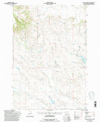
1993 Map of Hells Canyon
USGS Topo · Published 1996About this map
The Short Pine Hills define the western landscape of this corner of Harding County, where the topography transitions into the steep drainage of West Hells Canyon. This is a territory of high-plains ranching and seasonal waterways, anchored by the Dillon Ranch and the network of unpaved tracks like Dillon Road and Collins Road. The drainage patterns are clearly delineated, showing how Valley Creek, Ash Coulee, and Cady Creek carry runoff toward the South Fork Moreau River in the south.
Find a feature on this map
14 named features on this map. Tap any name to fly to it.
Don’t see what you’re looking for? This feature index may not catch every label — zoom into the map to look around manually.
Map Details
Editions of this 1993 Hells Canyon Map
This is the sole edition of this map. No revisions or reprints were ever made.
Other maps of this area

1935 · Harding
USGS Topo · 1:125,000

1954 · Lemmon
USGS Topo · 1:250,000

1957 · Lemmon
USGS Topo · 1:250,000

1973 · Bog Creek
USGS Topo · 1:24,000

1973 · Hells Canyon
USGS Topo · 1:24,000
1977 · Harding
USGS Topo · 1:24,000
1978 · J K Butte
USGS Topo · 1:24,000
1978 · Indian Butte
USGS Topo · 1:24,000
1978 · Alkali Creek West
USGS Topo · 1:24,000
1978 · Gustave
USGS Topo · 1:24,000