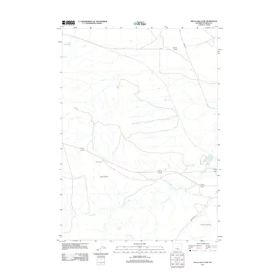
2012 Map of Hells Half Acre
USGS Topo · Published 2012About this map
Hells Half Acre defines this high-desert landscape in Natrona County, where geological erosion has carved a distinct basin into the Wyoming plateau. This 2012 survey illustrates a region shaped by both natural drainage and energy extraction, centered on the winding path of the S Fork Powder River. The industrial footprint is evident in the southeast at the Boone Dome Gas Field, while ranching and resource management are reflected in the various water catchments across the territory, including Lox Reservoir and Burlington Reservoir. The terrain is marked by prominent local landmarks like Shirttail Butte and the seasonal flows of Wallace Cr and Wyatt Draw. Connectivity across this open range is maintained by a network of rural routes such as Lox Rd and Powder River Rd, which navigate the draws and springs that define the local geography.
Find a feature on this map
12 named features on this map. Tap any name to fly to it.
Don’t see what you’re looking for? This feature index may not catch every label — zoom into the map to look around manually.
Map Details
Editions of this 2012 Hells Half Acre Map
This is the sole edition of this map. No revisions or reprints were ever made.
Other maps of this area
1951 · Square Top Butte
USGS Topo · 1:24,000
1952 · Waltman NW
USGS Topo · 1:24,000
1952 · Waltman
USGS Topo · 1:24,000

1955 · Arminto
USGS Topo · 1:250,000

1955 · Casper
USGS Topo · 1:250,000

1958 · Casper
USGS Topo · 1:250,000

1958 · Arminto
USGS Topo · 1:250,000
1959 · Gaylord Reservoir
USGS Topo · 1:24,000
1959 · Broad Mesa
USGS Topo · 1:24,000
1962 · Arminto
USGS Topo · 1:250,000