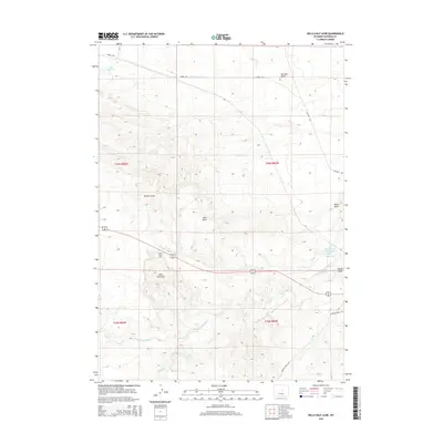
2015 Map of Hells Half Acre
USGS Topo · Published 2015About this map
Hells Half Acre defines the character of this Natrona County landscape, where the jagged badlands formations sit atop a high plateau before dropping toward the S Fork Powder River. The hydrology of this arid region is carefully documented, showing a network of intermittent drainage features like Ohio Draw, Hohnen Draw, and Wyatt Draw. To support the ranching or industrial needs of the area, several water catchments were established, including Lox Reservoir in the northwest and Burlington Reservoir in the east.
Find a feature on this map
18 named features on this map. Tap any name to fly to it.
Don’t see what you’re looking for? This feature index may not catch every label — zoom into the map to look around manually.
Map Details
Editions of this 2015 Hells Half Acre Map
This is the sole edition of this map. No revisions or reprints were ever made.
Other maps of this area
1951 · Square Top Butte
USGS Topo · 1:24,000
1952 · Waltman NW
USGS Topo · 1:24,000
1952 · Waltman
USGS Topo · 1:24,000

1955 · Arminto
USGS Topo · 1:250,000

1955 · Casper
USGS Topo · 1:250,000

1958 · Casper
USGS Topo · 1:250,000

1958 · Arminto
USGS Topo · 1:250,000
1959 · Gaylord Reservoir
USGS Topo · 1:24,000
1959 · Broad Mesa
USGS Topo · 1:24,000
1962 · Arminto
USGS Topo · 1:250,000