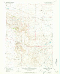
1968 Map of Hells Half Acre
USGS Topo · Published 1973About this map
Hells Half Acre dominates the central landscape of this Natrona County quadrangle, where the desert floor breaks into complex badlands. In the late 1960s, the region supported an industrial footprint centered on the Boone Field and a nearby Gas Plant, connected by an extensive network of pipelines. The local economy of this era relied on these energy resources and transport links, evidenced by the Landing Strip and the Burlington Northern Road.
Find a feature on this map
23 named features on this map. Tap any name to fly to it.
Don’t see what you’re looking for? This feature index may not catch every label — zoom into the map to look around manually.
Map Details
Editions of this 1968 Hells Half Acre Map
This is the sole edition of this map. No revisions or reprints were ever made.
Other maps of this area

1951 · Square Top Butte
USGS Topo · 1:24,000

1952 · Waltman NW
USGS Topo · 1:24,000

1952 · Waltman
USGS Topo · 1:24,000

1955 · Arminto
USGS Topo · 1:250,000

1955 · Casper
USGS Topo · 1:250,000

1958 · Casper
USGS Topo · 1:250,000

1958 · Arminto
USGS Topo · 1:250,000

1959 · Gaylord Reservoir
USGS Topo · 1:24,000

1959 · Broad Mesa
USGS Topo · 1:24,000

1962 · Arminto
USGS Topo · 1:250,000