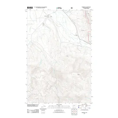
2011 Map of Helmville
USGS Topo · Published 2011About this map
Helmville serves as the central hub of this ranching and mining landscape in Powell County. The settlement is anchored by the Helmville Post Office, the Helmville Fire Dept, and two prominent local burial grounds: Saint Thomas Cemetery and Helmville Cemetery. The surrounding terrain is marked by significant extractive history, evidenced by the Treasure State Mine to the south and the Roselle Mine and Snowflake Mine to the north. Water management is a defining characteristic of the valley, with the North Helmville Canal and Lincoln Slough diverting flow through the area. Towards the south, the landscape rises toward the peak of Hoodoo Mountain, while the drainage of Cottonwood Creek and its various forks like Wet Cottonwood Creek define the western reaches of the quadrangle.
Find a feature on this map
29 named features on this map. Tap any name to fly to it.
Don’t see what you’re looking for? This feature index may not catch every label — zoom into the map to look around manually.
Map Details
Editions of this 2011 Helmville Map
This is the sole edition of this map. No revisions or reprints were ever made.
Other maps of this area

1889 · Helena
USGS Topo · 1:250,000

1893 · Helena
USGS Topo · 1:250,000

1899 · Helena
USGS Topo · 1:250,000

1903 · Helena
USGS Topo · 1:250,000

1919 · Drummond
USGS Topo · 1:125,000

1921 · Drummond
USGS Topo · 1:125,000

1947 · Butte
USGS Topo · 1:250,000

1958 · Butte
USGS Topo · 1:250,000

1958 · Drummond
USGS Topo · 1:62,500

1958 · Garrison
USGS Topo · 1:62,500