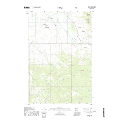
2020 Map of Helmville
USGS Topo · Published 2020About this map
Helmville serves as the focal point of this western Montana landscape, situated near the confluence of Nevada Cr and Lincoln Slough. The settlement is flanked by local burial sites, including Saint Thomas Cem to the north and Helmville Cem to the south, providing valuable touchpoints for genealogical research. The terrain transitions from the alluvial flats near Dry Gulch to the rising elevations of the Helena National Forest in the northeast and Hoodoo Mtn in the south.
Find a feature on this map
43 named features on this map. Tap any name to fly to it.
Don’t see what you’re looking for? This feature index may not catch every label — zoom into the map to look around manually.
Map Details
Editions of this 2020 Helmville Map
This is the sole edition of this map. No revisions or reprints were ever made.
Other maps of this area

1889 · Helena
USGS Topo · 1:250,000

1893 · Helena
USGS Topo · 1:250,000

1899 · Helena
USGS Topo · 1:250,000

1903 · Helena
USGS Topo · 1:250,000

1919 · Drummond
USGS Topo · 1:125,000

1921 · Drummond
USGS Topo · 1:125,000

1947 · Butte
USGS Topo · 1:250,000

1958 · Butte
USGS Topo · 1:250,000

1958 · Drummond
USGS Topo · 1:62,500

1958 · Garrison
USGS Topo · 1:62,500