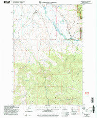
2001 Map of Helmville
USGS Topo · Published 2004About this map
Helmville sits at the northern edge of this map, serving as a focal point for the surrounding cattle country and timber lands at the turn of the 21st century. The landscape is defined by an intricate network of water management, visible in the Douglas Creek Canal and Canarway Canal, which divert flows across the valley floor to support local ranching. The terrain transitions from the low-lying Lincoln Slough and Nevada Creek bottomlands to the elevated peaks of the Helena National Forest in the southeast. High-elevation landmarks like Hoodoo Mountain overlook a complex drainage system including South Fork Cottonwood Creek and Cooper Creek. Evidence of the area's resource-based economy is found in the Roselle Mine and various gravel pits, while local genealogy is represented by a hilltop Cem and a lone Grave recorded near Canarway Canal.
Find a feature on this map
27 named features on this map. Tap any name to fly to it.
Don’t see what you’re looking for? This feature index may not catch every label — zoom into the map to look around manually.
Map Details
Editions of this 2001 Helmville Map
This is the sole edition of this map. No revisions or reprints were ever made.
Other maps of this area

1889 · Helena
USGS Topo · 1:250,000

1893 · Helena
USGS Topo · 1:250,000

1899 · Helena
USGS Topo · 1:250,000

1903 · Helena
USGS Topo · 1:250,000

1919 · Drummond
USGS Topo · 1:125,000

1921 · Drummond
USGS Topo · 1:125,000

1947 · Butte
USGS Topo · 1:250,000

1958 · Butte
USGS Topo · 1:250,000

1958 · Drummond
USGS Topo · 1:62,500

1958 · Garrison
USGS Topo · 1:62,500