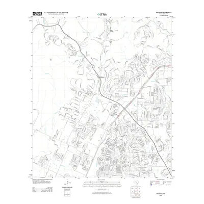
2013 Map of Helotes
USGS Topo · Published 2013About this map
Grey Forest and Helotes anchor this transition between the Balcones Escarpment and the San Antonio suburban expansion. The map details a complex network of residential development pressing against the rugged terrain of the Texas Hill Country, with significant elevations like Massive Mtn and Black Hill looming over the growing street grids. For genealogists and local historians, the landscape preserves older family markers such as Lee Cem, Menchaca Cem, and Madla Cem, which sit alongside the drainage basins of Helotes Cr and Culebra Cr. The heavy presence of the State Loop 1604 W corridor illustrates the modern connectivity of this Bexar County region, showing how contemporary infrastructure navigates the historical creek beds and limestone ridges that have defined the local geography for generations.
Find a feature on this map
19 named features on this map. Tap any name to fly to it.
Don’t see what you’re looking for? This feature index may not catch every label — zoom into the map to look around manually.
Map Details
Editions of this 2013 Helotes Map
This is the sole edition of this map. No revisions or reprints were ever made.
Other maps of this area

1953 · Otis Ridge
USGS Topo · 1:24,000

1953 · Culebra Hill
USGS Topo · 1:24,000

1953 · San Antonio West
USGS Topo · 1:24,000

1953 · Helotes
USGS Topo · 1:24,000

1953 · Castle Hills
USGS Topo · 1:24,000

1953 · Van Raub
USGS Topo · 1:24,000

1954 · San Antonio
USGS Topo · 1:250,000

1956 · Medina Lake
USGS Topo · 1:62,500

1957 · San Antonio
USGS Topo · 1:250,000

1958 · La Coste NE
USGS Topo · 1:24,000