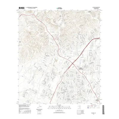
2016 Map of Helotes
USGS Topo · Published 2016About this map
Helotes serves as the focal point of this 2016 survey, where the suburban expansion of San Antonio meets the rising terrain of the Texas Hill Country. The landscape is defined by the sharp transition from the dense residential developments of Leon Valley in the southeast to the increasingly complex topography near Grey Forest and Black Hill in the northwest. This progression is traced through numerous drainage systems, including Helotes Cr and Culebra Cr, which carve through the limestone hills. Historical continuity is visible in the placement of the Menchaca Cem and Helotes Cem, while the modern transportation infrastructure is dominated by the C W Anderson Loop and Bandera Rd. The map provides a detailed look at contemporary land use, showing how residential pockets like Mustang Farm and Shetland Hills have integrated into the rugged canyon geography of Wildcat Canyon and Cross Mountain.
Find a feature on this map
328 named features on this map. Tap any name to fly to it.
Don’t see what you’re looking for? This feature index may not catch every label — zoom into the map to look around manually.
Map Details
Editions of this 2016 Helotes Map
This is the sole edition of this map. No revisions or reprints were ever made.
Other maps of this area

1953 · Otis Ridge
USGS Topo · 1:24,000

1953 · Culebra Hill
USGS Topo · 1:24,000

1953 · San Antonio West
USGS Topo · 1:24,000

1953 · Helotes
USGS Topo · 1:24,000

1953 · Castle Hills
USGS Topo · 1:24,000

1953 · Van Raub
USGS Topo · 1:24,000

1954 · San Antonio
USGS Topo · 1:250,000

1956 · Medina Lake
USGS Topo · 1:62,500

1957 · San Antonio
USGS Topo · 1:250,000

1958 · La Coste NE
USGS Topo · 1:24,000