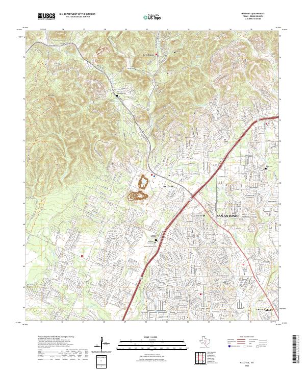
2022 Map of Helotes
USGS Topo · Published 2022About this map
Helotes and the surrounding Bexar County hill country are defined by a network of seasonal drainages and significant family heritage sites. This landscape, where the Balcones Escarpment meets the expanding suburbs of San Antonio, is dotted with numerous small burial grounds and landmarks that reflect generations of local settlement. From the Lee Cem in the north to the Ballscheit Family Cem further south, these sites offer specific points of interest for genealogists. The terrain is marked by significant features like Black Hill and Rhyder Ridge, while water sources such as Huesta Springs and Culebra Cr have historically shaped the development of the area. Modern infrastructure like Bandera Rd now connects the once-distinct community of Grey Forest with the larger metropolitan reach of Leon Valley, illustrating the suburban evolution of this region.
Find a feature on this map
390 named features on this map. Tap any name to fly to it.
Don’t see what you’re looking for? This feature index may not catch every label — zoom into the map to look around manually.
Map Details
Editions of this 2022 Helotes Map
This is the sole edition of this map. No revisions or reprints were ever made.
Other maps of this area

1953 · Otis Ridge
USGS Topo · 1:24,000

1953 · Culebra Hill
USGS Topo · 1:24,000

1953 · San Antonio West
USGS Topo · 1:24,000

1953 · Helotes
USGS Topo · 1:24,000

1953 · Castle Hills
USGS Topo · 1:24,000

1953 · Van Raub
USGS Topo · 1:24,000

1954 · San Antonio
USGS Topo · 1:250,000

1956 · Medina Lake
USGS Topo · 1:62,500

1957 · San Antonio
USGS Topo · 1:250,000

1958 · La Coste NE
USGS Topo · 1:24,000