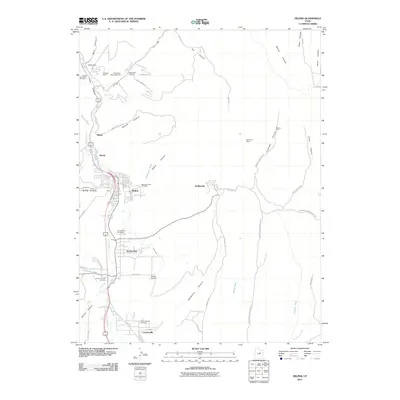
2011 Map of Helper
USGS Topo · Published 2011About this map
Kenilworth and Helper anchor this industrial landscape of the Carbon County coalfields, where the narrow canyons of the Wasatch Plateau meet the Price River valley. The map reveals a complex infrastructure of mining and settlement, featuring the Castle Gate Mine Number 1 and Castle Gate Mine Number 4 near the northern narrows of the canyon. A notable density of burial sites, including the Austrian Central Cemetery and Mountain View Cemetery, reflects the cultural diversity and history of the local workforce.
Find a feature on this map
61 named features on this map. Tap any name to fly to it.
Don’t see what you’re looking for? This feature index may not catch every label — zoom into the map to look around manually.
Map Details
Editions of this 2011 Helper Map
This is the sole edition of this map. No revisions or reprints were ever made.
Other maps of this area

1886 · Price River
USGS Topo · 1:250,000

1896 · Price River
USGS Topo · 1:250,000

1914 · Castle Gate
USGS Topo · 1:62,500

1915 · Wellington
USGS Topo · 1:62,500

1916 · Castle Gate
USGS Topo · 1:62,500

1956 · Price
USGS Topo · 1:250,000

1960 · Price
USGS Topo · 1:250,000

1962 · Price
USGS Topo · 1:250,000
1969 · Kyune
USGS Topo · 1:24,000
1969 · Minnie Maud Creek West
USGS Topo · 1:24,000