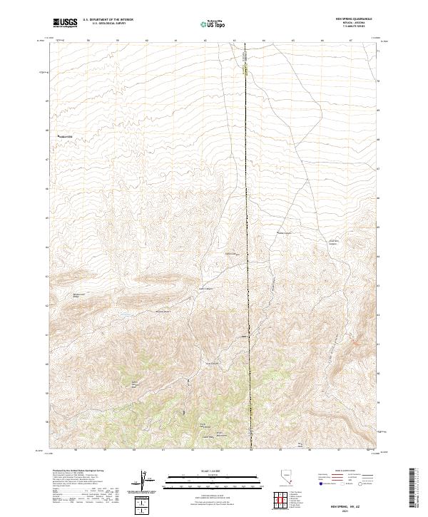
2021 Map of Hen Spring
USGS Topo · Published 2021About this map
Hen Spring provides a vital water source in the arid landscape of the Mojave Desert near the Virgin Mountains. This 2021 topographic study by the U.S. Geological Survey details the rugged drainage systems of the Virgin River basin, including the deeply incised paths of Middle Canyon, Lime Kiln Canyon, and Cabin Canyon. The map records the intersection of the Clark County, Nevada and Mohave County, Arizona borders, highlighting the complex public land survey system that defines this remote desert interior. Notable elevations like Bunkerville Ridge and Virgin Peak Ridge overlook a network of seasonal washes such as Cedar Wash and Cow Canyon, illustrating the hydrological patterns of the regional watershed.
Find a feature on this map
9 named features on this map. Tap any name to fly to it.
Don’t see what you’re looking for? This feature index may not catch every label — zoom into the map to look around manually.
Map Details
Editions of this 2021 Hen Spring Map
This is the sole edition of this map. No revisions or reprints were ever made.
Other maps of this area

1886 · Saint Thomas
USGS Topo · 1:250,000

1886 · Mt. Trumbull
USGS Topo · 1:250,000

1892 · Mt. Trumbull
USGS Topo · 1:250,000

1893 · Saint Thomas
USGS Topo · 1:250,000

1953 · Grand Canyon
USGS Topo · 1:250,000

1954 · Las Vegas
USGS Topo · 1:250,000

1954 · Littlefield 3 SW
USGS Topo · 1:24,000

1954 · Littlefield
USGS Topo · 1:62,500

1954 · Cane Springs
USGS Topo · 1:62,500

1957 · Las Vegas
USGS Topo · 1:250,000