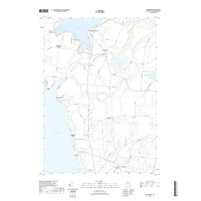
2019 Map of Henderson
USGS Topo · Published 2019About this map
Henderson Harbor and the village of Henderson serve as the focal points for this coastal reach of Jefferson County, where the transition from agricultural uplands to the Lake Ontario shoreline defines the local geography. The map reveals a high density of ancestral burial grounds, including the North Cem near Stony Point and the inland Stowles Cem, offering valuable data for genealogical research.
Find a feature on this map
85 named features on this map. Tap any name to fly to it.
Don’t see what you’re looking for? This feature index may not catch every label — zoom into the map to look around manually.
Map Details
Editions of this 2019 Henderson Map
This is the sole edition of this map. No revisions or reprints were ever made.
Other maps of this area

1893 · Sackets Harbor
USGS Topo · 1:62,500

1895 · Sacketts Harbor
USGS Topo · 1:62,500

1895 · Stony Island
USGS Topo · 1:62,500

1895 · Pulaski
USGS Topo · 1:62,500

1942 · Stony Point
USGS Topo · 1:31,680

1942 · Henderson Bay
USGS Topo · 1:31,680

1942 · Point Peninsula
USGS Topo · 1:31,680

1942 · Sandy Creek
USGS Topo · 1:24,000

1943 · Henderson
USGS Topo · 1:31,680
1943 · Sackets Harbor
USGS Topo · 1:31,680