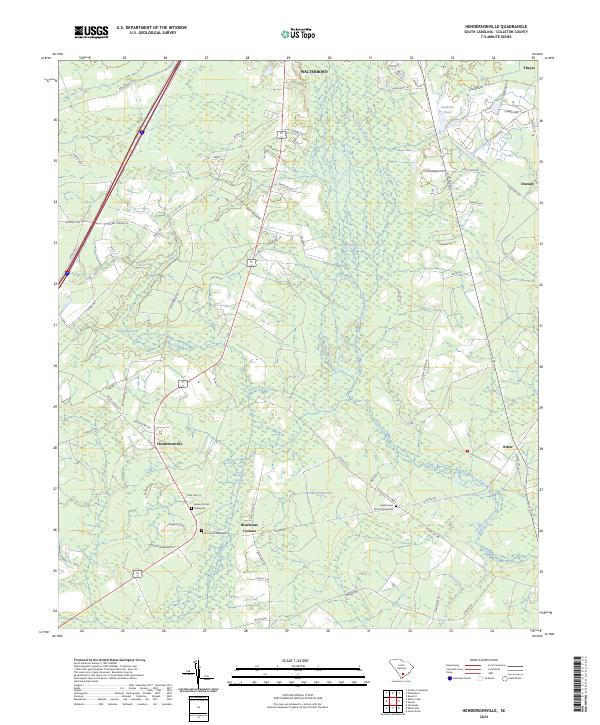
2024 Map of Hendersonville
USGS Topo · Published 2024About this map
The Ashepoo River meanders through the heart of this Lowcountry landscape, defining a region characterized by expansive wetlands and established rural communities. Several distinct swamps, including the Great Swamp, Remick Swamp, and Bluehouse Swamp, dominate the drainage patterns between the larger settlements of Walterboro and Hendersonville. The map captures a high level of detail for local history, recording the locations of multiple burial grounds such as the Grover Church Graveyard, Zion Church Graveyard, and Saint James Church Graveyard. These sites, along with small crossroads like Bluehouse Corners and Ritter, reflect the enduring settlement patterns of Colleton County. The modern transportation network is anchored by Interstate 95 and U.S. Route 17 Alternate, which cut through the forested terrain and bypass the older agrarian centers.
Find a feature on this map
71 named features on this map. Tap any name to fly to it.
Don’t see what you’re looking for? This feature index may not catch every label — zoom into the map to look around manually.
Map Details
Editions of this 2024 Hendersonville Map
This is the sole edition of this map. No revisions or reprints were ever made.
Other maps of this area

1918 · Walterboro
USGS Topo · 1:62,500

1918 · Green Pond
USGS Topo · 1:62,500

1918 · Yemassee
USGS Topo · 1:62,500

1919 · Cummings
USGS Topo · 1:62,500

1943 · Yemassee
USGS Topo · 1:62,500

1943 · Green Pond
USGS Topo · 1:62,500

1943 · Cummings
USGS Topo · 1:62,500

1943 · Walterboro
USGS Topo · 1:62,500

1947 · Savannah
USGS Topo · 1:250,000

1948 · Savannah
USGS Topo · 1:250,000