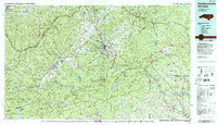
1986 Map of Hendersonville
USGS Topo · Published 1986About this map
Hendersonville and the surrounding Blue Ridge foothills are captured in this mid-1980s compilation by the Tennessee Valley Authority. This topographic record documents the complex intersections of the Southern Railway and the winding Blue Ridge Parkway during a period of expanding infrastructure. The landscape is defined by its water management and conservation boundaries, featuring the Pisgah National Forest and Nantahala National Forest alongside significant reservoirs like Lake Toxaway and the North Saluda Reservoir.
Find a feature on this map
105 named features on this map. Tap any name to fly to it.
Don’t see what you’re looking for? This feature index may not catch every label — zoom into the map to look around manually.
Map Details
Editions of this 1986 Hendersonville Map
2 editions found
Other maps of this area

1886 · Walhalla
USGS Topo · 1:125,000

1888 · Pickens
USGS Topo · 1:125,000

1891 · Cowee
USGS Topo · 1:125,000

1892 · Walhalla
USGS Topo · 1:125,000

1893 · Mt Guyot
USGS Topo · 1:125,000

1894 · Asheville
USGS Topo · 1:125,000

1894 · Pickens
USGS Topo · 1:125,000

1896 · Walhalla
USGS Topo · 1:125,000

1897 · Cowee
USGS Topo · 1:125,000

1900 · Mount Mitchell
USGS Topo · 1:125,000