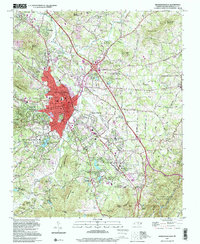
1997 Map of Hendersonville
USGS Topo · Published 2001About this map
Hendersonville serves as the focal point of this late 20th-century survey, illustrating the urbanization of this highland region. The industrial and transportation corridor follows the Southern Railway as it passes through Barker Heights and East Flat Rock, while institutional land use is evident at the Bonclarken Assembly Grounds and the Mud Creek Assembly Grounds. For genealogists, the map is particularly useful for locating numerous small burial sites and sanctuaries such as the Mt Pisgah Ch Beagle Cem, St Matthews Cem, and Stanford Chapel.
Find a feature on this map
117 named features on this map. Tap any name to fly to it.
Don’t see what you’re looking for? This feature index may not catch every label — zoom into the map to look around manually.
Map Details
Editions of this 1997 Hendersonville Map
This is the sole edition of this map. No revisions or reprints were ever made.
Other maps of this area

1905 · Pisgah
USGS Topo · 1:125,000

1906 · Pisgah
USGS Topo · 1:125,000

1907 · Saluda
USGS Topo · 1:125,000

1935 · Standingstone Mtn.
USGS Topo · 1:24,000

1935 · Horse Shoe
USGS Topo · 1:24,000

1935 · Batcave
USGS Topo · 1:24,000

1935 · Hendersonville
USGS Topo · 1:24,000

1935 · Fishtop
USGS Topo · 1:24,000

1935 · Zirconia
USGS Topo · 1:24,000

1936 · Skyland
USGS Topo · 1:24,000