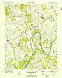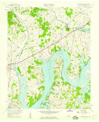
1957 Map of Hendersonville
USGS Topo · Published 1959About this map
Old Hickory Lake dominates the landscape in this late 1950s survey, illustrating the transformation of the Cumberland River valley following the completion of the dam just years prior. The reservoir's reach is visible deep into Drakes Creek, surrounding newly formed landmarks like Harbour Island and flooding the lowlands of Lindsley Bend. While the water changed the geography, the established upland communities remained centered on local institutions such as Beech Sch and St Johns Ch.
Find a feature on this map
48 named features on this map. Tap any name to fly to it.
Don’t see what you’re looking for? This feature index may not catch every label — zoom into the map to look around manually.
Map Details
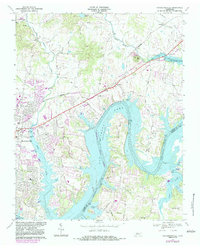
Editions of this 1957 Hendersonville Map
This is the sole edition of this map. No revisions or reprints were ever made.
Historical Maps of Nashville Through Time
8 maps found