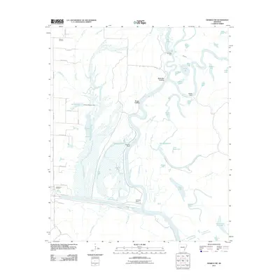
2011 Map of Henrico SW
USGS Topo · Published 2011About this map
White River oxbows and deltaic wetlands dominate this part of Arkansas County, where the river winds through significant geological features like Buffalo Bend and Cow Pen Bend. The landscape is a complex network of bayous and lakes, including La Grue Bayou, Paradise Bayou, and East Moon Lake, illustrating the hydrological volatility of the region before modern intervention. Small river-access points like Prairie Landing and Jacks Bay Landing represent the local interface with the water, while the Arkansas Post Canal cuts a straight path across the southern portion of the map, contrasting with the natural meandering of Honey Locust Bayou. Local history is anchored by the Malcolm Cemetery and Hockenberry Cemetery, providing specific points of interest for genealogists tracking family roots in this low-lying river country.
Find a feature on this map
59 named features on this map. Tap any name to fly to it.
Don’t see what you’re looking for? This feature index may not catch every label — zoom into the map to look around manually.
Map Details
Editions of this 2011 Henrico SW Map
This is the sole edition of this map. No revisions or reprints were ever made.
Other maps of this area

1935 · Red Fork
USGS Topo · 1:62,500

1935 · Gillett
USGS Topo · 1:62,500

1939 · Henrico
USGS Topo · 1:62,500

1939 · Big Island
USGS Topo · 1:62,500

1948 · Helena
USGS Topo · 1:250,000

1950 · Helena
USGS Topo · 1:250,000

1953 · Greenwood
USGS Topo · 1:250,000

1954 · Henrico
USGS Topo · 1:62,500

1955 · Helena
USGS Topo · 1:250,000

1956 · Greenwood
USGS Topo · 1:250,000