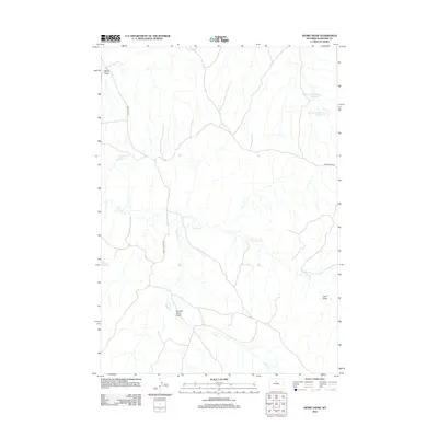
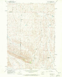
2012 Map of Henry Draw
USGS Topo · Published 2012About this map
Henry Draw and the surrounding drainage basins of Washakie County define this high-plains landscape. The topography is dominated by intermittent waterways and specialized water management features, including Seaman Hill Reservoir and the Hampton Reservoir Number 3 and Number 4 complex. These reservoirs, alongside Pinky Reservoir, illustrate the critical infrastructure required for ranching or land management in an arid environment. Transportation across the territory relies on a sparse network of named routes such as Nowater Rd, Murphy Dome Rd, and the descriptively named Devils Slide Rd. The area is further characterized by significant topographic depressions including Murphy Dome Draw and Sand Draw, while the winding courses of Nowater Cr and Mud Cr suggest the seasonal flow patterns of the Wyoming interior.
Find a feature on this map
12 named features on this map. Tap any name to fly to it.
Don’t see what you’re looking for? This feature index may not catch every label — zoom into the map to look around manually.
Map Details
Editions of this 2012 Henry Draw Map
This is the sole edition of this map. No revisions or reprints were ever made.
Other maps of this area

1955 · Arminto
USGS Topo · 1:250,000

1958 · Arminto
USGS Topo · 1:250,000
1960 · Coyote Hill
USGS Topo · 1:24,000
1960 · Packsaddle Creek
USGS Topo · 1:24,000
1962 · Arminto
USGS Topo · 1:250,000
1966 · Zimmerman Buttes
USGS Topo · 1:24,000
1966 · Banjo Flats West
USGS Topo · 1:24,000
1966 · Cabin Fork
USGS Topo · 1:24,000
1966 · Wagon Prong
USGS Topo · 1:24,000
1966 · Bader Draw
USGS Topo · 1:24,000