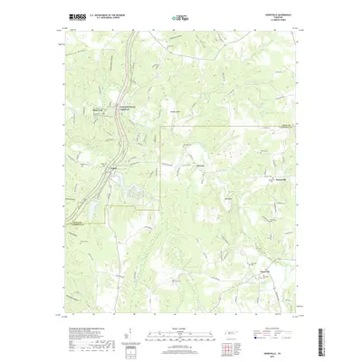
2019 Map of Henryville
USGS Topo · Published 2019About this map
The Buffalo River meanders through the heart of the central Tennessee backcountry, dividing the landscape of Lewis and Lawrence counties. This 2019 survey captures a rural landscape defined by narrow hollows and numerous watercourses like Chief Cr and Saw Br. The Natchez Trace Parkway serves as a modern corridor through this historic terrain, passing by the site of Metal Ford and the settlement of Napier. Local history is preserved in several small burying grounds throughout the hills, including Old Salem Cem and Brock Cem.
Find a feature on this map
113 named features on this map. Tap any name to fly to it.
Don’t see what you’re looking for? This feature index may not catch every label — zoom into the map to look around manually.
Map Details
Editions of this 2019 Henryville Map
This is the sole edition of this map. No revisions or reprints were ever made.
Other maps of this area

1901 · Colombia
USGS Topo · 1:125,000

1905 · Waynesboro
USGS Topo · 1:125,000

1936 · Riverside
USGS Topo · 1:24,000

1936 · Deerfield
USGS Topo · 1:24,000

1936 · Mt Joy
USGS Topo · 1:24,000

1936 · Henryville
USGS Topo · 1:24,000

1936 · Ethridge
USGS Topo · 1:24,000

1936 · Crestview
USGS Topo · 1:24,000

1936 · Kimmins
USGS Topo · 1:24,000

1936 · Gordonsburg
USGS Topo · 1:24,000