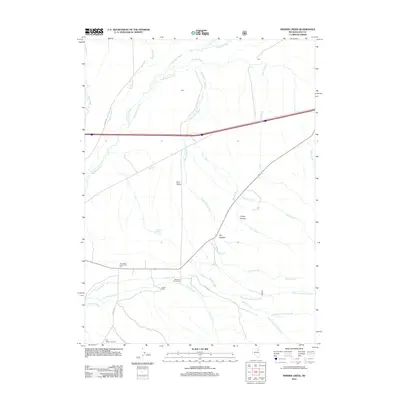
2012 Map of Herder Creek
USGS Topo · Published 2012About this map
Starr Valley serves as the central focal point of this high-desert ranching landscape in northeastern Nevada. The map documents a network of family-held lands and water resources, notably Mountain View Ranch and Jaynes Ranch, which are situated along the lower slopes where Herder Creek and Ackler Creek descend toward the valley floor. Social and civic life is anchored by the Starr Valley Community Hall and the Starr Valley Cemetery, preserving the location of long-established community footprints.
Find a feature on this map
31 named features on this map. Tap any name to fly to it.
Don’t see what you’re looking for? This feature index may not catch every label — zoom into the map to look around manually.
Map Details
Editions of this 2012 Herder Creek Map
This is the sole edition of this map. No revisions or reprints were ever made.
Other maps of this area
1935 · Halleck
USGS Topo · 1:125,000

1955 · Wells
USGS Topo · 1:250,000

1955 · Elko
USGS Topo · 1:250,000

1958 · Wells
USGS Topo · 1:250,000

1958 · Elko
USGS Topo · 1:250,000

1961 · Wells
USGS Topo · 1:250,000

1962 · Elko
USGS Topo · 1:250,000

1965 · Elko
USGS Topo · 1:250,000
1967 · Welcome
USGS Topo · 1:24,000
1967 · Twin Buttes
USGS Topo · 1:24,000