
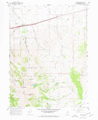
1967 Map of Welcome
USGS Topo · Published 1971About this map
Starr Valley and the Humboldt Range dominate this northern Nevada landscape, where the small settlement of Welcome sits near the crossing of major transportation corridors. The mid-century infrastructure of the late 1960s is clearly visible, featuring the dual paths of the S P RR and W P RR railroads alongside Interstate 80. Water management for power and recreation is a central theme, evidenced by the Powerplant and Penstock Siphon along Trout Creek, as well as high-elevation destinations within the Humboldt National Forest like Angel Lake and Smith Lake. The map details the transition from the high peaks of Greys Peak and Chimney Rock down to the drainage of Clover Creek and the southern Clover Valley. Local industry is represented by scattered mining operations, including an Open Pit Mine and several gravel pits, providing a look at the region's extraction and transit history.
Find a feature on this map
42 named features on this map. Tap any name to fly to it.
Don’t see what you’re looking for? This feature index may not catch every label — zoom into the map to look around manually.
Map Details
Editions of this 1967 Welcome Map
2 editions found
Other maps of this area

1935 · Halleck
USGS Topo · 1:125,000

1955 · Wells
USGS Topo · 1:250,000

1955 · Elko
USGS Topo · 1:250,000

1958 · Wells
USGS Topo · 1:250,000

1958 · Elko
USGS Topo · 1:250,000

1961 · Wells
USGS Topo · 1:250,000

1962 · Elko
USGS Topo · 1:250,000

1965 · Elko
USGS Topo · 1:250,000

1967 · Herder Creek
USGS Topo · 1:24,000

1967 · Metropolis
USGS Topo · 1:24,000